
History 2019
|
19.10 |
DOWNLOAD | 30. October 2019 |
| This version is not available on the update site | ||
Experimental:
Delete Tag / Tag Category
This is a New Feature
A new feature that deletes something should always be used with care and attention.
This feature has been tested and worked properly. However, backing up the tour data is always a good advice.
| New + Improvements |
Views
Added the ability to see, for a given activity, month or year, the percentage of time spent in each cadence zone "slow" and "fast".
Added the ability to see for a given activity, month or year, the average elevation change per unit of distance.
Tools Tour Editor
Dialog Quick Edit
Tour Filter
TCX Export (Frederic)
Import Import Preferences (Frederic)
FitLogEx File (Frederic)
FIT File (Frederic)
TCX File
|
||||||||
| Changes |
Altitude → Elevation (Frederic)
Tour Book View
Tour Editor
Icons
|
||||||||
| Bugfix |
Tour Chart
Weather (Frederic)
Body Weight Unit (Frederic)
Fitlog Import (Frederic)
Fitlog Import + Tour Book View The tour start time was wrong and needed these 2 fixes
Import (Frederic)
CM4xxM Import (Meinhard)
|
||||||||
| Translation |
|
||||||||
| System |
Eclipse 2019-09 (4.13)
|
|
19.7.1 |
DOWNLOAD | 8. August 2019 |
| This version is not available on the update site | ||
| Bugfix |
Easy Import Configuration
|
| Translation |
19.7.0
|
|
19.7.0 |
DOWNLOAD | 25. July 2019 |
| This version is not available on the update site | ||
| New |
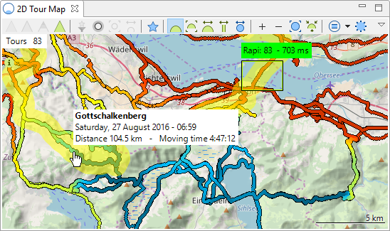
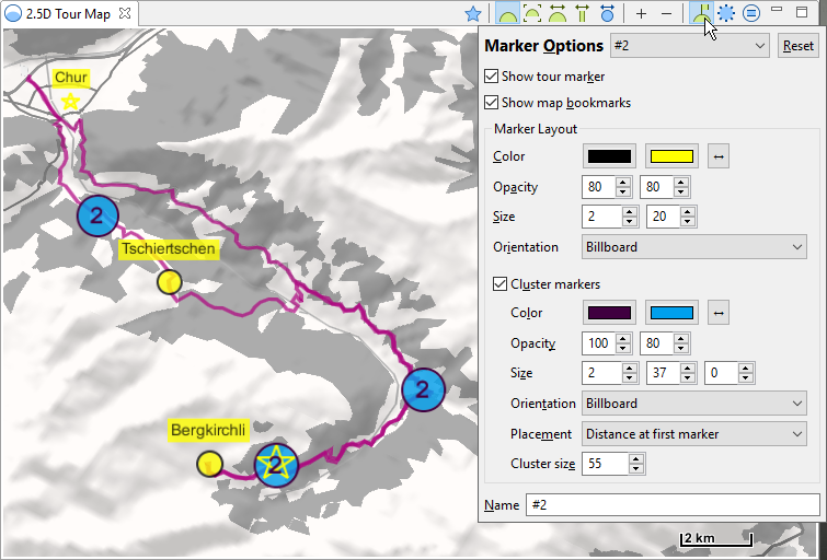
2D Map
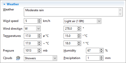
Weather Frederic
You need to purchase an API Key to use this feature This is the first time in the history of MyTourbook, that you need to pay for a new feature. The problem is, it seams that there is no website where you can get historical weather data for free. Without an API key, any new weather fields can be edited/saved as all other tour fields, they are just not filled automatically. This API key can be tested 60 days for free, how to use it is documented here.
|
| Improvements |
2D Map Options
|
| Bugfix |
Tour Book View
Preferences Frederic
Easy Import Config Frederic
Marker deletion Frederic
Import Frederic
|
| Translation |
|
| System |
Eclipse 2019-06 (4.12)
|

|
19.6.1 |
DOWNLOAD | 4. June 2019 |
| This version is not available on the update site | ||
|
Important |
2D Map Since a few days, OpenStreetMap do not allow any more the download of map tile images as it was done in the last 11 years. All older version of MyTourbook can not display map tile images from OpenStreetMap. This fix do apply the tile image policy of OpenStreetMap which allows again to download map tile images. |
|
19.6.0 |
DOWNLOAD | 2. June 2019 |
| This version is not available on the update site | ||
|
2D Map There are currently issues with the default map from OpenStreetMap and some drag & drop map providers, this will be fixed in the next version.
|
|
| New |
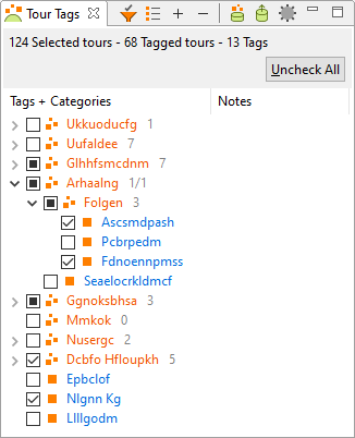
Tour Tag + Tag Category
Tour Book
Statistics
2D Map Frederic
Easy Import (Frederic)
|
| Improvements |
Adjust Altitude
Import
Statistics
|
| Bugfix |
.fitlog File
IllegalArgumentException: Widget has the wrong parent
File Re-Import Frederic
Tour Info Tooltip
|
| Translation |
|
| System |
|
|
19.4.0 |
DOWNLOAD | 24. April 2019 |
| This version is not available on the update site | ||
| New |
2D Map
There can still be some minor issues and room for improvements
|
| Improvements |
Search Tour by Location
Thomas
Import
Compare Result Views
|
| Changes |
2D Map
Tour Chart
|
| Bugfix |
2D Map
Tour Chart
Import
|
|
Important Infos.fit Import The .fit file importer is simplified/restructured to fix an issue. Afterwards it was tested with several different .fit files. It is still possible that there are undiscovered issues. So check your tour data after the next imports to ensure that all values are available and valid. Bad News for 3D Map 3D Map will be suspended after May 3, 2019 https://worldwind.arc.nasa.gov/news/2019-03-21-suspension-faq/ |
|
|
19.3.1 |
DOWNLOAD | 3. March 2019 |
| This version is not available on the update site | ||
| Bugfix |
Fixed ClassCastException in the Views
|
|
19.3.0 |
DOWNLOAD | 1. March 2019 |
| This version is not available on the update site | ||
32 Bit Platforms are dropped
Why ?
There was the problem that the preferences dialog took a very long time (minutes) to open it with Linux because of this bug.
This issue has been fixed in Eclipse 4.9. However, to use the latest official version of Eclipse, 4.10, this version is now used, but it only supports the 64 bit platforms.
→ MyTourbook now only supports the 64 bit platforms
| Improvements |
Search Tour by Location
|
| Bugfix |
Easy Import Dialog
System
|
| System |
Eclipse 4.10 - 64 bit |
|
19.2.0 |
DOWNLOAD | 23. February 2019 |
| This version is not available on the update site | ||
|
24. February 2019 This version can have a problem when updating the database from older versions → Download is removed |
|
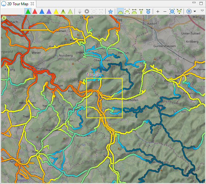
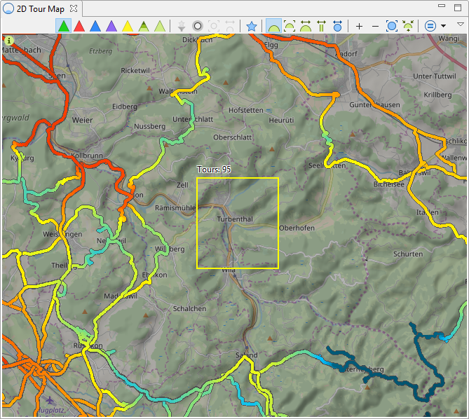
| New |
Search Tour by Location It finds all tours in the map within a geo rectangle of 0.01° Examples 1. All displayed tours have passed through the selected area (yellow rectangle), e.g. this can find tours which are started from home.
2. It can also find tours which did not drive through the selected area, e.g. this can find tour which are not started from home.
EXPERIMENTAL This feature is in a very early stage and has some issues, but in some parts it is already working
|
| Improvements |
Splash screen
|
| Bugfix |
All Maps
Join Tours
|