

 3D Map
The 3D Tour Map view can display tours which are selected in other views, e.g. Tour Book view, these tours must contain geo position data (GPS) that it can be displayed in this map.
This map can be opened with this ![]() icon in the toolbar or in the application menu Tour/3D Tour Map.
icon in the toolbar or in the application menu Tour/3D Tour Map.
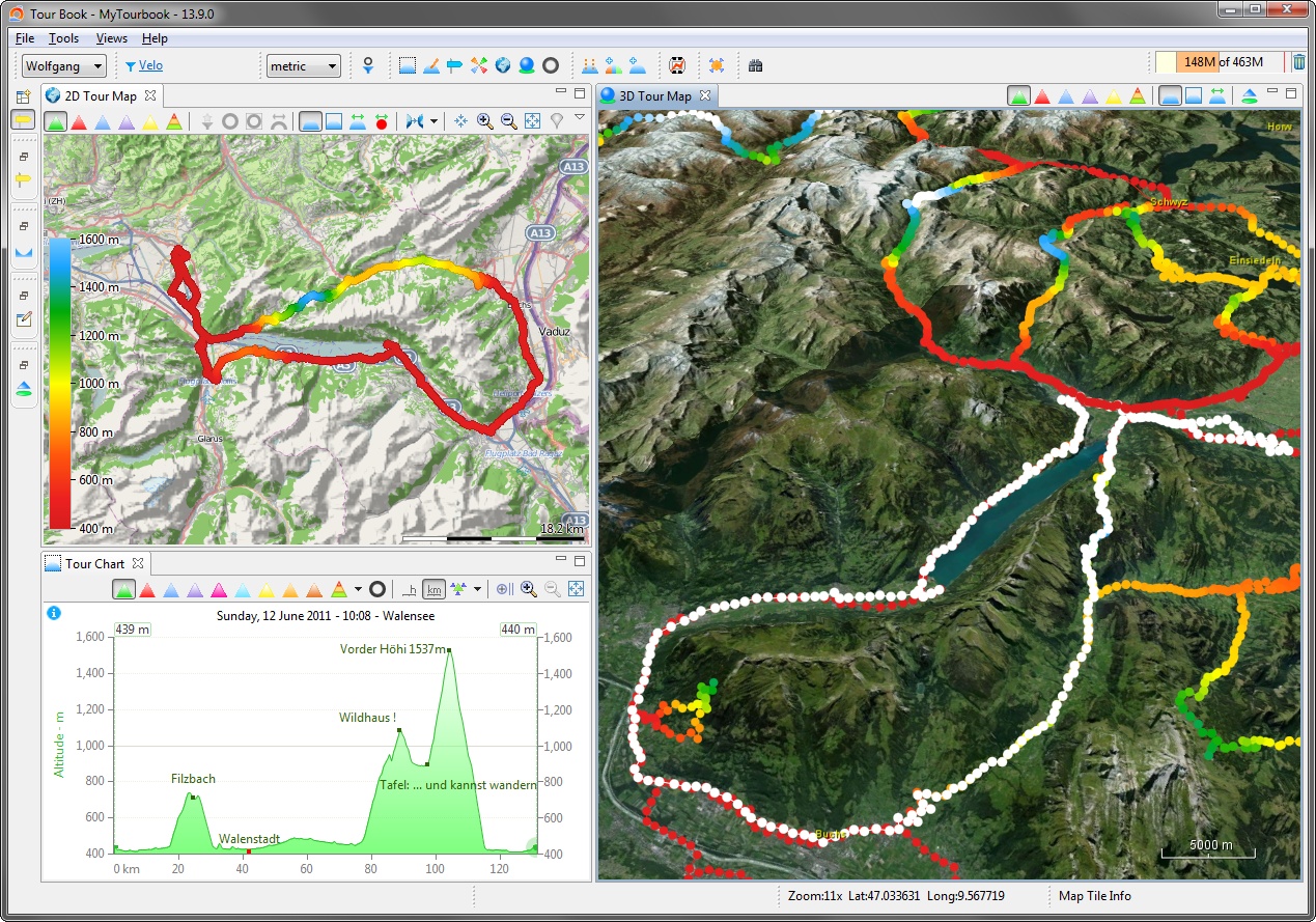
This map is based on the NASA World Wind SDK which provides many features and examples but only a fraction of it is used now.
3D Map is not displayed?
See here how this could be solved.
|
3D Map can crash
The 3D map can suddenly crash when displaying tour tracks. This do not happen very often but it can. So before using tour tracks, it is a good idea to save your data, e.g. Tour Editor, that you don't have to create it again. A crash will create a log file in the program folder which shows that the drawing of tour tracks (path) caused it. I just started my 3D programming skills and did some hacks that the tour track color could be changed smoothly and fast which seems to cause the crash. I hope that sometimes I fully understand what I've implemented now (version 13.09). |
Map Navigation
Map navigation can be done with the buttons in the Map Navigator layer or with the Default Controls (mouse + keyboard) which are described here (in the lower part of the page).
This page is updated for version 14.4
