History 2013


Version: 13.11.1   4. December 2013

Download

Not available.

Installation

Install from the update site, version 13.11.0 is required.

New 3D Map Features


Fixed Problems

Fixed title type ahead problem, it was introduced in the last version.


Other

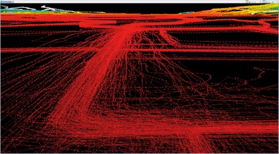
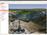
3D experimental images.
this is intentionally blank


Version: 13.11.0 » download « 25. November 2013
This version cannot be installed from the update site.
Platform Mac OS X is discontinued Why ?
New 3D Map Features
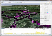
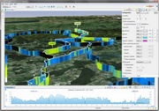
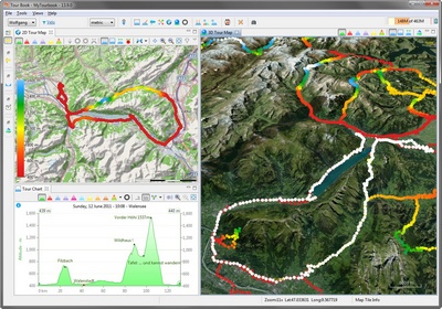
  • Improved tour track configuration having:
    • Multiple configurations.
    • Draw curtain with track color.
    • Relative altitude offset.
    • Randomized altitude offset.
  • Show hovered position value.
  • Show tour direction (with arrows).
  • Show tour chart slider.
  • Sync tour chart slider with map.
  • Tour legend is displayed correctly on all platforms.
gradient curtain track color speed curtain track color Ubuntu 13.10
Ubuntu 13.10
with corrected legend

Fixed Bugs

  • POI search is fixed partly, this quick fix do not yet have any features as it was before.
    POI search is not yet supported for 3D map.


Ubuntu Problem

  • It is possible, that the application menu is not displayed with Ubuntu. This problem can be fixed by setting
    export UBUNTU_MENUPROXY=0
    before MyTourbook is started.


Crash Stability

  • Crash stability in this version is much better than the previous version but it is not yet perfect, crashes still can happen but not very often, mostly when many tours (hundreds) are displayed.

    In this version, the tour rendering was rewritten which helped to reduce crashing.


WorldWind SDK

  • Update from 1.5 to 2.0 revision 1721, this increased the application size from 60 to 65 MByte.
this is intentionally blank


MyTourbook ᴟƨᴉяԀ Edition


Version 13.9 cannot be downloaded in English language,

only languages from "Old Europe" are available.


Default language is German.


Version: 13.9 » download « 16. September 2013
This version cannot be installed from the update site .
New

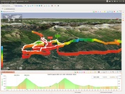
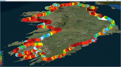
3D map has been improved and can show tours now but all 2D map features are not yet implemented. However, this map do contain features which are not available in the 2D map, e.g. select a tour.


map with multiple tours

map with multiple tours
Multiple Tours


3d map with tours
Select a Tour


Mac OS X

Problem

It is possible that this version will not run properly on OS X. It can happen that the icon for the 3D map appears 2x times and they are disabled.

To solve this problem do an application cleanup as it is described here and reinstall the application. You will not loose your data but a backup is always a good idea.


Linux + Mac OS X

Problem

The tour legend in the 3D map looks ugly on Linux and OS X.

It was a last minute action (even it took several hours to implement it) before the product for this app was created and it was not tested on Linux + Mac but was running (almost) smoothly on Windows.

Just disable the legend (in the context menu) when you don't like it, it will be improved in the next version but not now.

this is intentionally blank


Version: 13.4.2   16. June 2013

Download

Not available.

Installation

Install (5 MByte) from the update site , version 13.4.x is required.

Improvements
  • Toggle X-Axis Time in the tour chart between

    • Recording time (relative time)
    • Day time (absolute time)
    • Day time with photo time adjustment (this is new)


Fixed Problems

  • Show photos in the tour map when photos are not yet loaded in other views. This implementation is still not yet perfect but much better than before. The problem is described here.
  • Sort photos correctly in the Tour Photos view when multiple tours are selected.
  • Sort tours by date/time when exporting multiple tours.


These problems have been fixed in order to improve the display of images in the map.
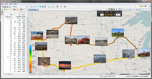
 

map with multiple tours
this is intentionally blank


Version: 13.4.1   29. April 2013

Download

Not available.

Installation

Install (5 MByte) from the update site , version 13.4.0 is required.

New

Fixed Bugs

  • A splitted tour can cause these errors:
    • A tour marker can be out of array bounds.
    • NPE occured when last time slice is split.
  • Show photo annotations at the correct position when images cannot be loaded.


Experience with
3D Map & Linux

In the release notes of version 13.4 it was written that Linux can crash using the new 3D map. This is still true but it also depends on the used graphic card.

When having a computer (notebook) with an onboard and a 2nd graphic card, it can work successfully with the onboard graphic card but it can crash with the 2nd graphic card.

Doriano Cometto sent this screenshot.

this is intentionally blank


Version: 13.4 » download « 13. April 2013
This version cannot be installed from the update site .

Minor Modifications

  • Changed wording for actions in the calendar view.


Updates

  • Improved Italian translation, provided by Doriano Cometto.
  • Improved French translation, provided by Vincent Di Sanzo.


Fixed Bugs

  • PDF printing issues caused by int -> long restructuring (1 year ago)
    • Markers are not sorted.
    • Marker distance is not displayed.

  • Fixed problem when importing FIT files from o-synce Navi2Coach, provided by Marcin Kuthan.


Experimental Feature

3D Map

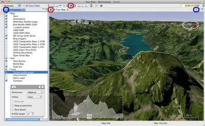
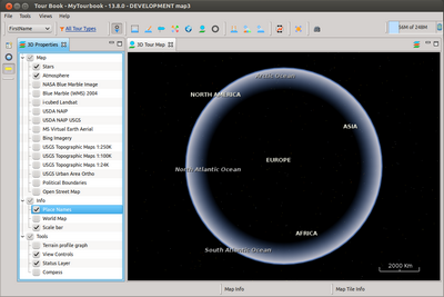
map 3d example

This map is currently just a "simple" map with a few features:

  • Show/hide map layer

  • Terrain profile graph tool

It is planned that tours and photos are also displayed.

This map is displayed with the NASA WorldWind SDK (why the application is now 10 MByte larger than before).


3D Map Demos

There are many demos which shows features which can be implemented in this map.


Why is WorldWind used instead of Google maps ?

  • Pro Google
    • There are many areas where Google map is better than WorldWind.
  • Pro WorldWind
    • No Ads.
    • No Google dependency.
    • No Google internet connection.
    • No over-engineered map navigation.
    • Anything can be customized.


Map navigation

Map navigation can be done with the buttons in the View Controls layer or with the Default Controls (mouse + keyboard) which are described here (in the lower part of the page).


One Click Area

The 3D Properties view contains an area where layers can be activated/deactivated very easily with the mouse.

This area is on the right site of the view and it's width is one third of the whole view width. The mouse cursor will change when this area is hovered.

Clicking inside this area is doing these actions:

  • Show/hide map layer.
  • Collapse/expand layer category.


Terrain profile graph

The Terrain profile graph tool can not be dragged to another location (like in the screenshot) because it's not working correctly with Linux.


Linux: Crash out of the box :-(

When running this 3D map in a Linux environment within VMWare it caused a lot of problems, native Linux is not yet tested.

This map is running smoothly with Win 7 and OSX 10.6 (when you have a good graphic card :-)


Problems

  • MyTourbook can crash when showing "Open Street Map" layer. It can display a few tiles but then it crashes.
  • A lot of exception's can occure (see console) when showing layers which draw map tiles.


Used Linux test environment

  • VMWare 8.0.5
  • Ubuntu 12.04
  • JRE version: 7.0_13-b20
  • Java VM: Java HotSpot(TM) Client VM (23.7-b01 mixed mode linux-x86 )


These layers can be displayed without problems

  • Stars
  • Atmosphere
  • Place Names
  • Scale bar
  • Terrain profile graph
  • View Controls
  • Status Layer


map 3d linux problem
3D Map with Linux


this is intentionally blank


Version: 13.2 » download « 6. February 2013
This version cannot be installed from the update site .
New Features

Photo workflow is now complete

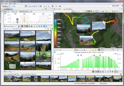
photo workflow

It took 12 months to implement this simple feature: "Show tour photos in the map" and there are still some parts which can be improved.


Tour Photo Filter

  • when this filter is activated, only tours with photos will be displayed. This affects ALL views, special views are excluded, e.g. tour import view.


Photos + Tours view

  • save photos in a tour, when a tour contains photos, they can be displayed in the tour chart, tour map and tour photo views
  • displays number of saved photos and time adjustment
  • new filter to show only tours which contain photos but the photos are not yet saved in a tour


Tour Chart view


Tour Map view

  • filter photos by rating stars
  • set photo image size
  • there is a painting problem for photos which is described here


All photo galleries

  • star rating can be set for photos when they are saved in a tour. When a photo is saved in multiple tours, star rating can currently not be set (this situation can occure when more than one person is saving the same photo)


Behaviour changed

Tour Chart view

  • there is a different hovering algorithm for the mouse location and photo marker background color


Fixed Bugs

Tour Book view

  • all average values are wrong, they included tours which values are not set -> average values are too small 3599360
   
NEW: MyTourbook Mailing List

You can subscribe to this mailing list and you will receive a message only when a new version is published.

When you have subscribed, you will receive an automated welcome mail which says that you can send messages to this mailing list, this feature is disabled.
this is intentionally blank


2012

2014