

History 2012
| Version: 12.12.1 | 28.
December 2012 |
| Download |
not available |
| Installation |
install (5 MByte) from the update site , version 12.12.0 is required |
| Fixed Bugs |
|
| Version: 12.12.0 | » download « | 12.12.12 |
| New Features |
|
||
|
New Experimental Features |
|
||
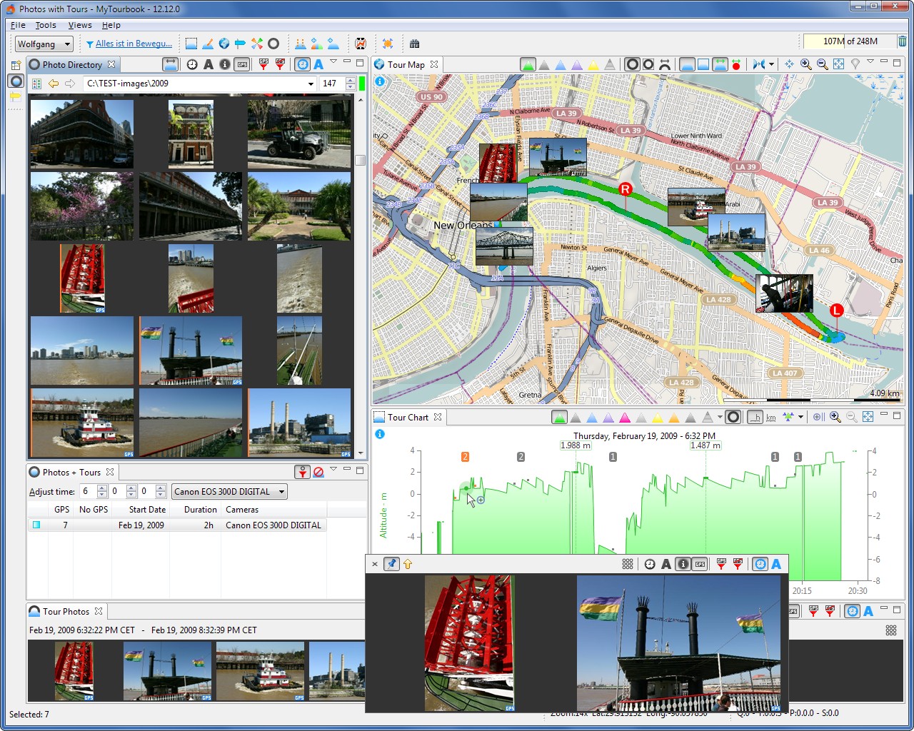
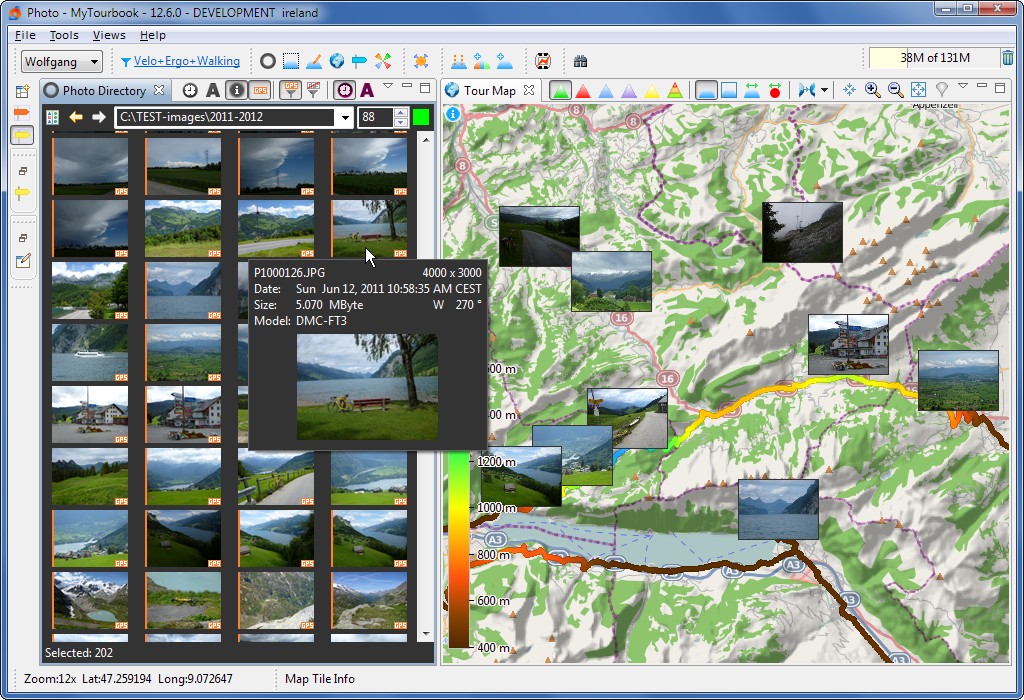
| 2 examples when photos are linked with tours | |||
Version
12.12 can crash on Linux
During my testing, the application crashed using Ubuntu 12.04. This log entry is displayed in the Eclipse console: mytourbook: /build/buildd/cairo-1.10.2/src/cairo-surface.c:637: cairo_surface_destroy: Assertion `((*&(&surface->ref_count)->ref_count) > 0)' failed. Aborted (core dumped)
|
|||
| Improvements |
|
||
| Behaviour changed |
|
||
| Fixed Bugs |
|
||
| New Splash |
|
||
| Development |
|
||
| System |
|
||

| Version: 12.6.2 | 29.
July 2012 |
| Download |
not available |
| Installation |
install (4.7 MByte) from the update site , version 12.6.1 is required |
| Fixed Bugs |
Update existing tours
To update existing tours with this bugfix (it's possible that statistic views are wrong), press button Compute HR Zones... in the preference dialog People / Tab: Heartrate Zones
|
| Version: 12.6.1 | »download« | 17.
July 2012 |
All tours will be removed (NOT deleted) from this view, when this view or the application is closed.
The old behaviour can be activated in the view menu by unchecking:
"Remove all tours from this view when it is closed"
| Improvements |
|
| Fixed Bugs |
|
| System |
|
| Version: 12.6 | »download« | 21.
June 2012 |
| New |
|
| Experimental Feature |
|
| Improvements |
|
| Other modifications |
|
| Fixed Bugs |
|
| System |
|
| Fixed Bugs |
| Version: 12.1.2 | »download« | 17.
March 2012 |
|
This version do not contain new features or
bugfixes compared with the last patch: This version was created to do an easier installation of version 12.1 with all it's bug fixes. |
| Version: 12.1.1 Patch
#1 |
24.
February 2012 |
| Installation |
version 12.1.1 is required when 12.1.1 is installed, download these patch files files are removed and follow the patch install instructions |
| Fixed Bug |
|
| Version: 12.1.1 |
25.
January 2012 |
| Download |
not available |
| Installation |
install (4.6 MByte) from the update site , version 12.1 is required you should install ALL features even when you don't use it because the feature o_synce Macro will now hide nasty dialogs when a tour import fails |
| Improvements |
|
| Fixed Bug |
|
| Version: 12.1 Patch
#1 |
20.
January 2012 |
| Fixed Bug | 3474177Incorrect
display of temperature in main display
(this are aftermaths from the big restructuring in version 12.1)
Other Implications
Database Update (Version 21)This patch will modify the tour database structure which needs about 45 seconds for 1800 tours in the first startup.
Download + Install
|
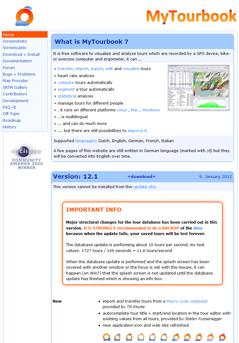
| Version: 12.1 | »download« | 9.
January 2012 |
Major structural changes for the tour database has been carried out in this version. It is STRONGLY recommended to do a BACKUP of the data because when the update fails, your saved tours will be lost forever.
The database update is performing about 10 tours per second, my test values: 1727 tours / 149 seconds = 11.6 tours/second
When the database update is performed and the splash screen has been covered with another window or the focus is set with the mouse, it can happen (on Win7) that the splash screen is not updated until the database update has finished which is showing an info box.
| New |
|
| New Chart Features |
|
| Improvements |
|
| Fixed Bugs |
|
| Development |
|
| System |
|
Website update 9. January 2012
|
|
| old | new |
