History 2014


    29. December 2014
Bugfix

Updated all 2D map providers and replaced hillshading server #89

The easiest way to use the updated map providers is to delete all old map providers and to install the new map providers. All actions can be done in this dialog.

You should not delete all old map providers when you are using other map providers which are not available in the default 2D map providers list.

this is intentionally blank


14.14 ALPHA DOWNLOAD 22. November 2014
This version is not available on the update site  

This is VERY important

Create a BACKUP of your tour data BEFORE you start version 14.14.

Why ?

Version 14.14 will upgrade the tour database to a new database version. After this is done, there is NO possibility to open the tour database with an older version of MyTourbook.

Experimental

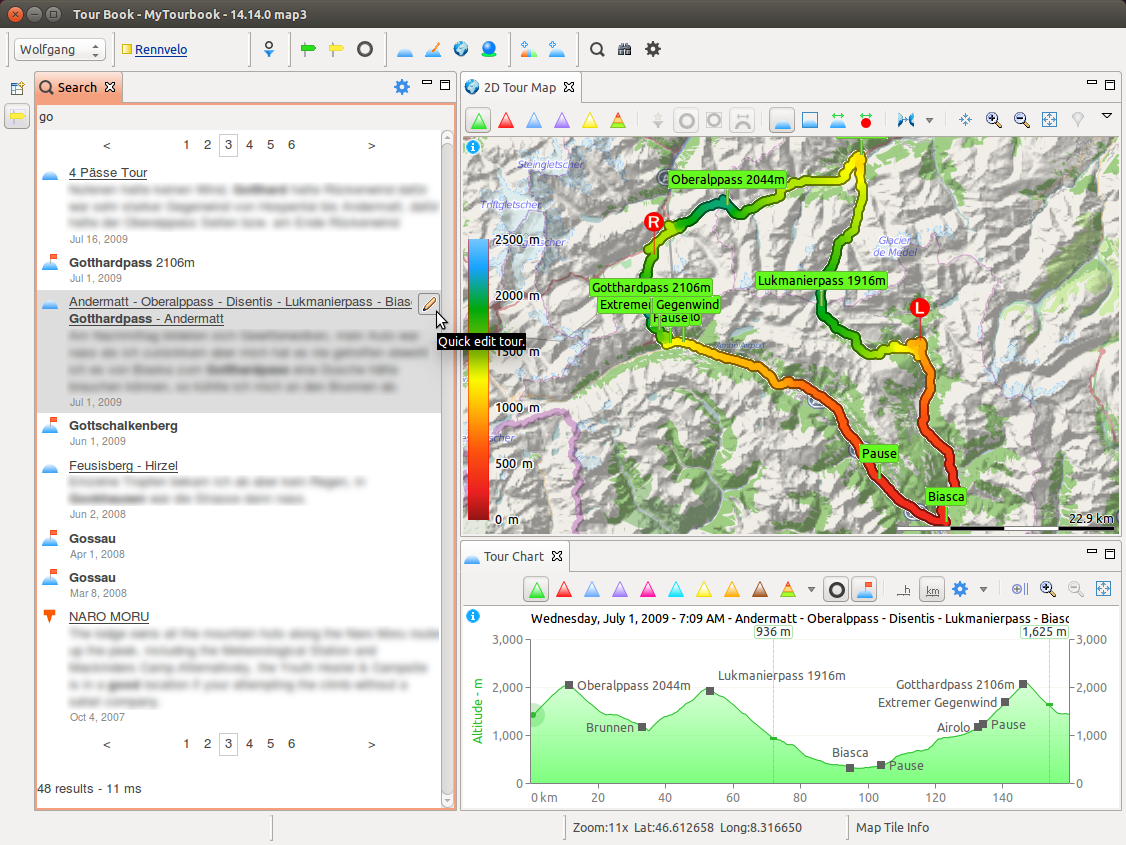
Fulltext Search 

You can do a text search for tours, markers and waypoints.

ft-search-obfuscated-v1414


Current Limitations

Any tours, markers or waypoints which are added, updated or deleted, are not depicted in the search result.

Workaround for these limits

Close Search view and reopen it. This will create the fulltext index from scratch, which takes about 1-3 seconds for 4000 tours with a SSD.


System
  • Derby database 10.11.1.1
  • Lucene fulltext search engine 4.10.1
this is intentionally blank


14.10.1   10. November 2014
Download Not available.
Installation Install (6 MByte) from the update site, version 14.10 is required.
New

Czech Language

This new language is translated by Lukas Novotny.


Bugfix

Tour database update for version 14.10 can fail.

Luckily this is not dramatically because this update can be repeated without damaging any data. The error occured when setting tour properties, e.g. geo location into a tour marker. This process is necessary that the new feature to show all tour marker is working.

This fix

  • Provides a button to start the update again, available in the preferences dialog General/Tour.
  • Has better error handling. When the error occure, it is better logged and only the affected tour marker is ignored and not the whole update process.
this is intentionally blank


14.10 DOWNLOAD 22. October 2014
This version is not available on the update site  
New

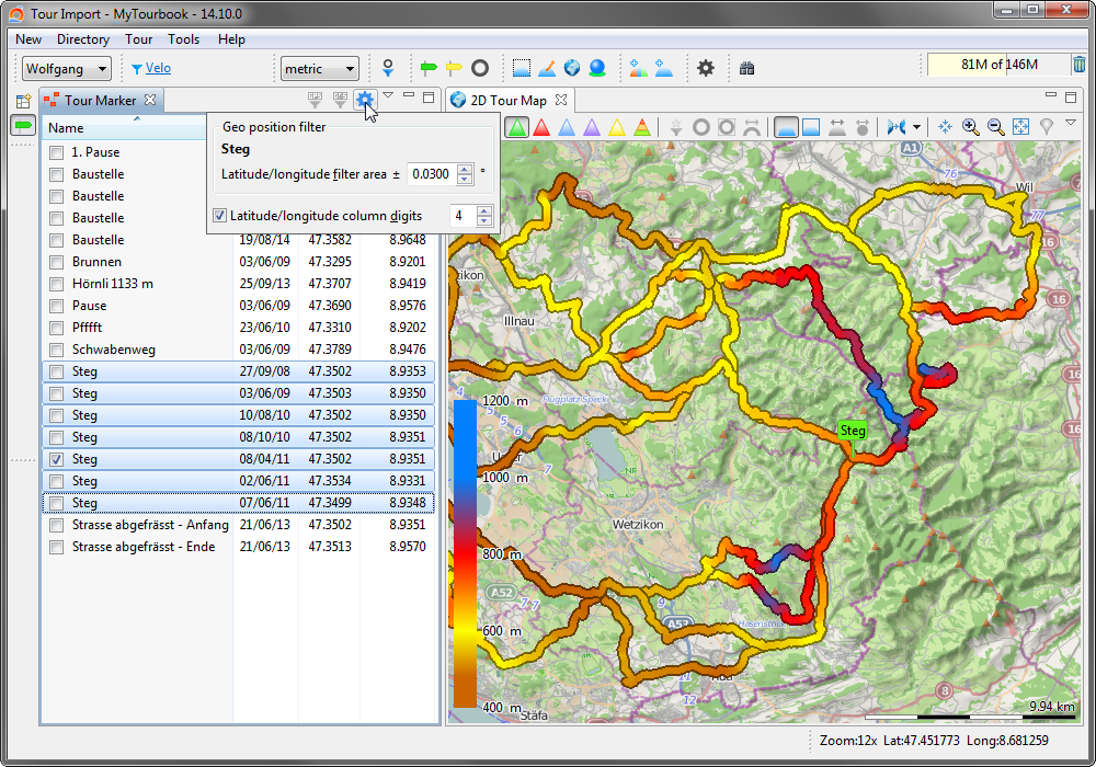
All Tour Marker View

This new view shows all tour markers from all tours.

all-tour-marker-multiple-tours-v1410

Tour Book

Export view in CSV format. 


Improvements

Tour Chart

  • Force min/max values.
    • Force min/max values separately, existing min/max values have been reset to default values.
    • Force values for altimeter/gradient/heartbeat/pace.
    • Fixed some bugs when min/max value is enforced.
  • Live update for tour chart preferences.
  • When a vertical slider is moved in the tour chart with a hovered mouse, the tour chart view must not be activated any more (another view can be the active view) that the moved slider is also updated in other views, e.g. 2/3D Map, Tour Analyzer.
  • Removed border line on the left side of the tour chart graphic (this was a drawing bug since centuries).


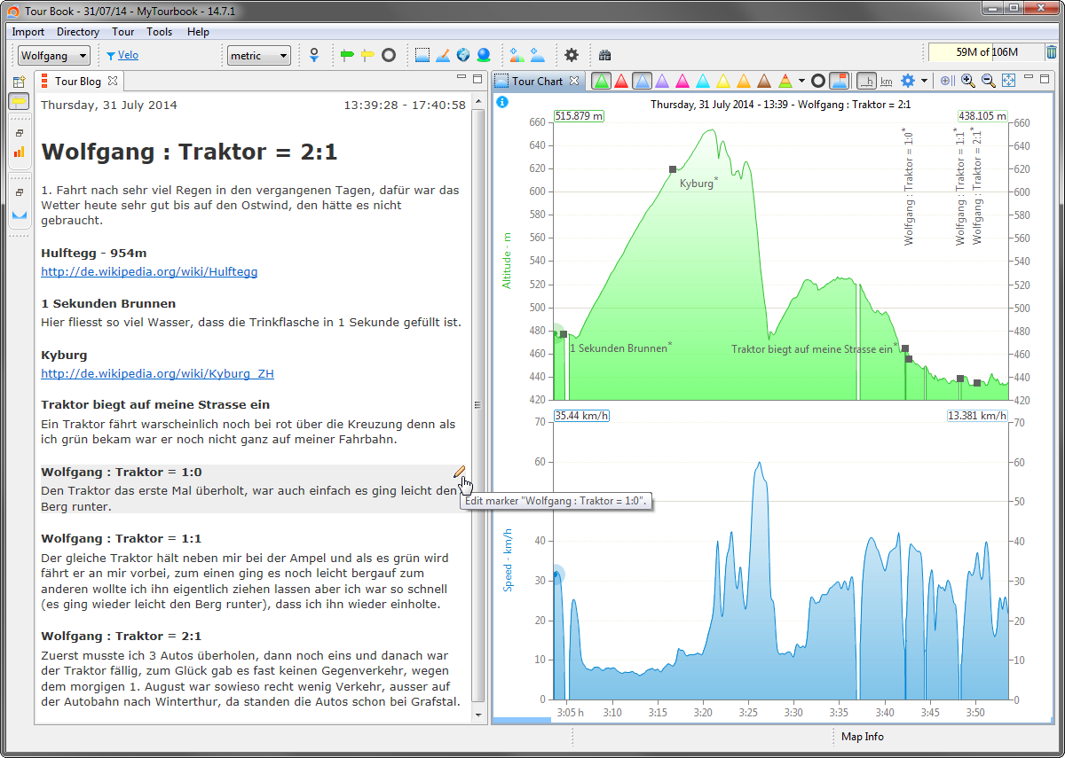
Tour Blog ...

  • Set marker visible/hidden.
  • Show/hide hidden marker.
  • Draw marker with hidden/device/default color.
  • Improved hovered style.
  • Support for Linux.


All Table/Tree Views

New actions in the column header context menu.

  • Show all columns.
  • Show default columns.
 
App
  • Renamed ImportNew  in the app menu.
  • Changed wording
    Transfer Tours ...Receive Tours ... serial port
 
Fixed Bugs
  • Tour blog is not displayed with Linux because the web browser causes an error. This problem can be solved when XULrunner is installed, see here...


This Website
  • Modernized this website with some CSS modifications.
this is intentionally blank


14.9 DOWNLOAD 6. September 2014

This version is not available on the update site


Sorry for the bad readability. The background color, which is choosen here, is mainly oriented at the season of the year. After the autumn 2014 has started, also the fog is sometimes all around.
New
  • Import Suunto 3 .sml files.


Import
Improvements

Fit import

  • Rectify temperature values when importing files.
  • Reimport temperature values for existing tours.


GPX import

  • <gpxdata:distance> tags can contain relative or absolute distance values.


Suunto 2 import

  • Import laps in Suunto 2 .xml files.


Common

  • Compute distance values from geo positions when distance values are not available.
  • Moved all import setting from the import view menu into the import preference dialog.


Other
Improvements

2D map


Tour chart


Fixed Bug
  • The import of any .xml formats failed when the <xml... tag and other tags are on the same line.


This Website

  • Menu UI refresh.
  • Set style for tables which list actions, properties...
this is intentionally blank


14.8 DOWNLOAD 16. August 2014
This version is not available on the update site
New


Improvements
  • Recognize new Garmin devices, e.g. Fenix2.
  • Show firmware version in import view (when available).


Fixed Bug
  • Show 3D map with 64 bit Java, Bug #86


System
  • Update to FIT SDK 12
  • Update to WorldWind SDK revision 2230
this is intentionally blank


Version: 14.7.1   7. August 2014
Download Not available.
Installation Install (6 MByte) from the update site , version 14.7.0 is required.

New


tour-blog-v140701


Linux Info

It is very likely that the Tour Blog is not working with Linux, this error can occure: No more handles [Unknown Mozilla path (MOZILLA_FIVE_HOME not set)]

This feature is based on the browser widget, there are some hints which may help you to get it to work (MyTourbook 14.7 is based on Eclipse 3.8).

 
Language
  • French translation for 14.7.0
this is intentionally blank


Version: 14.7.0 » download « 28. July 2014
This version is not available on the update site
Tour Marker

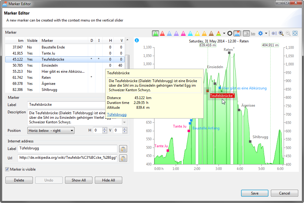
There are many improvements for the tour marker.

tour-marker-dialog

  • New tour marker properties
    • Description
    • Internet address
  • Tour marker editor is restructured.
    • Edit new properties.
    • Select a marker in the tour chart graphic.
    • A moving slider in the tour chart (or selecting a marker) is also moved in an opened 2D/3D map view in the workspace.
      This is not the best solution but much better than before. It's a compromise because implementing a map within the marker dialog would be very very time consuming. The 2D/3D maps are tight very closely to the 2D/3D map views.
  • Tour chart
    • Slideout to set tour marker display options.
    • Tooltip for a tour marker and open a url in the browser.
    • Doubleclick a tour marker will open the marker dialog.
    • Context menu actions for a marker.
  • 3D Map
    Map is positioned when a tour marker is selected in the tour chart and the track sliders are displayed in the 3D map.
 
App
  • App menu and toolbar is restructured.

  • Tourmap Ansicht Tour Catalog is renamed into Tourmap Ansicht  Referenz Tours.

  • Tour marker tab in the  tour editor is removed because it was a redundance of the tour marker view.

  • Removed some actions from the workspace toolbars to streamline the UI, these actions are available in the application menu: Tagged Tour, Tour Analyzer, Tour Segmenter.

 
Elevation Gain

The algorithm to compute the elevation gain/loss is replaced with the Douglas Peucker algorithm.

The new algorithm can be fine tuned with the Douglas Peucker tolerance which can be assessed in the tour segmenter.

These parts have been modified to implement the new algorithm.


Why is the old algorithm replaced?

Because the author is now the owner of a .fit device and discovered on the first tour, that the elevation gain with the old algorithm can be significantly wrong, it depends on the terrain.

 
Improvements
  • Table/Tree Columns
    Columns can be set visible/hidden in the header context menu in all tables/trees which are using the column manager.
  • Tagging view

    Keep expanded/collapsed tags/categories when the view is closed and reopened.

  • Tour Analyzer
    • Removed unnecessary digits.
    • Is updated when another tour is selected.
  • Fit import
    Fixed problem when lap markers are saved in different formats in the .fit file.
  • CSV import
    Altutide up/down can also be imported.
 
System
  • Removed TourCategory entity, it have never been used.
  • Removed some tour database tables which have never been used.
this is intentionally blank


Version: 14.4.0 » download « 11. April 2014
This version cannot be installed from the update site.
System
  • Java 7 is the new required platform.
    This should not be a problem because Java 6 is outdated but not yet fully buried.

New 3D Map Features
  • 3D Map Layer view 3D Map Layer is converted into a slideout.

map3-layer-view-restore-error-small

When this error Problems occurered restoring perspective is displayed after starting version 14.4, just ignore it. It is displayed only the first time when a perspective is restored.

This error can occure when the 3D Map Layer view was visible or hidden before version 14.4 was installed. This view is now removed and replaced with the slideout.

  • Set layer opacity.
  • Draw a line from a slider (left/right/hovered) to the surface.
    This simple feature took me 3 weeks to implement it but it also helped me, to unterstand a little bit more of OpenGL.

New

  • Patch from 17. February 2014
    Import power and speed data from .tcx files when the data are enclosed in these tags: <ns3:Speed> <ns3:Watts>
  • Patch from 5. March 2014
    Import cadence and heartrate data from .gpx files when the data are enclosed in these tags: <cadence> <heartrate>

Improvements

  • The same tour can now be imported two times.
    This modification required a restructuring of the tour id creation for ALL supported import formats, see here for more details.
VERY IMPORTANT


.fit data files

Imported and saved .fit files from previous versions (14.2 and older) are not recognized as already saved tours, because the old implementation used a wrong algorithm to create the tour id. The import of .fit files with the current version 14.4 and future versions of MyTourbook will create a different tour id.

Already imported and saved .fit tours work as before, it's just the creation (and first save) of a tour which creates the tour id.

So, please take care when you try to import already saved .fit tours because the Database Status column (first column) in the import view do not display the correct state.


Other data file formats

It's possible that other data file formats can have the same problem like the .fit files.
During my testing this problem occured when a tour contained only a few (e.g. 2) timeslices or had other issues.
The Database Status of regular tours should be displayed correctly.

Fixed Bugs

  • Fixed bug in TCX import when <DistanceMeters> is less than zero.
this is intentionally blank


Version: 14.2.0 » download « 8. February 2014
This version cannot be installed from the update site.
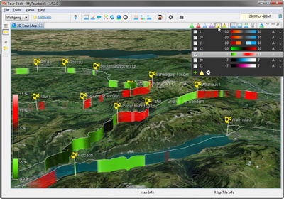
New 3D Map Features

3D map

Other New Features

  • Set track color in 2D map context menu.
  • Moved time slice clipping from tour chart properties view into the initial smoothing algorithm UI.
  • Reorganizes structure in preference dialog, moved some appearance pages to their correct parent.

Fixed Bugs

  • Power and gradient was 10 times higher when using initial smoothing algorithm.
  • Removed delay when app is closing and 3D map was not displayed.
  • #77: new tours by dividing/concenated tours: not saved in database.
this is intentionally blank


2013

2015