History 2010


Version: 10.11 patch
2. December 2010

This patch can be installed only from the update siteand requires version 10.11

After doing the software update, sometimes the first restart fails and you have to kill the application, the second restart is successful.
Improvements Polar .pdd import
  • get calories from .pdd file, .hrm file do not contain calorie values


Polar Personal Trainer .xml import

  • get distance values from speed/time values,
    this is used when distance values are not available
  • get tour title from <name> tag
  • get tour type from <sport> tag,
    a corresponding tour type is automatically created


Version: 10.11 »download« 19. November 2010
This version can be installed ONLY from the download site 10.11
New Features
  • import SportTracks .fitlog files »...
  • import Polar .pdd files (RS800x) »...
  • import Polar Personal Trainer .xml files »...
Improvements
  • support for temperature values in 1/10 celcius
  • new field for a tour: weather description


Version: 10.10 patch   12. October 2010

This version can be installed only from the update siteand requires version 10.10

After doing the software update, sometimes the first restart fails and you have to kill the application, the second restart is successful.
Improvements
  • import Polar .hrm files from any devices which provide the internal data version 106 »...


Version: 10.10   7. October 2010
This version can be installed ONLY from the download site 10.10
When the mouse is hovering over some spots within the application, a popup window with additional info or other features is displayed automatically. This can be very annoing but the behaviour can be customized in the preference dialog.
Popup customization is not yet done for all mouse hover spots. Just let me know when there are still annoing spots (there is no Adblock Plus or NoScript plugin for MyTourbook).
New Features
  • import Polar .hrm files (CS400) »...

New tools, available in the tour book view context menu

  • compute distance values from geo position
  • set altitude values to SRTM data (when geo positions are available)
Improvements Tour type selection
  • replaced tour type selection combo box with a link and a selection menu
  • tour type can be selected with up/down keys or mouse wheel (when hovered menu is disabled)
  • selection menu is displayed when hovered with mouse, behaviour can be customized in the preference dialog»...

Tour info tooltip
  • display tooltip in tour directories when date/time/title/tags columns are hovered
  • locations: tour book, tour import, tour catalog, tagged tours
  • can be customized in the preference dialog»...
  • tooltip is horizontally positioned starting from the middle of the column to the right side when enough space is available, otherwise to the left side

Tour editor
  • new fields: altitude up/down
  • recording time: different fields for read and edit mode to fix locale issues

Tour views
  • when a tour is double clicked in a view, the action can be customized in the preference dialog»...

Year statistic view for the tour catalog
  • added tour info tooltip
  • selection for number of years is now easier (with a combobox)

Mac OS X
  • adjusted width for some input fields
Bugfix
Tour chart
  • vertical slider displayed sometimes wrong values
    -> synchronized slider in tour map was jumping when the value was wrong

Mac OS X
  • removed vertical stripes for painting tour in enhanced mode in the map
  • enhanced mode painting can crash the application in Mac OS X,
    a warning is displayed when selected
Platform
  • Eclipse 3.6.1
  • rxtx 2.2pre2
Development
  • FIT data import is now based on the official Garmin SDK,
    provided by Marcin Kuthan
  • restructured application to solve problems with velocity which is used in the Garmin serial data transfer and tour export


Version: 10.7 »download« 26. July 2010

!!! Very Important !!!

Read the following info when using Java 1.6.0_21: Oracle JVM 6u21 and Eclipse

New Features
  • print tour into pdf file, provided by Jo Klaps »... (2019950)
  • import hac4linux tours, provided by Meinhard Ritscher »...
Touren Liste display tour info in the tour chart, map + statistics »...
  • import and display gpx waypoints »...
  • concatenate multiple tours into one tour »...
  • split or extract a tour »... (2796537)

Improvements Tour editor
  • new action: set tour distance to 0 and delete distance values for all timeslices to fix recorded distances which are totally wrong »...
  • new action: set tour start distance to 0 »...
  • new action: compute distance values from geo positions »...
  • new fields: tour creation and modification time
  • expand description field size to the available space
  • validate length for text fields when tour is saved

Tour map
changed behaviour
  • mouse double click set's the center of the map but is NOT zooming in as it was done in previous version
  • display only one map instead of repeating maps on the horizontal axis
improvements
  • keep map center point even when the map is completely zoomed out
  • faster loadinging for offline tile images

Various
  • tour context menu: select recently used tour types »...
  • tour import: reselect multiple tours after application restart
  • tourbook view: change person for a tour »... (2986755)
  • tour type pref page: select and expand new tour type
  • import ciclotour with german csv header »...

Bugfix
  • tour type pref page: creating multiple tour types at once caused image dispose error (bug existed since beginning, it's now fixed :-)
  • tour editor: disable actions when a table cell is edited

Mac OSX
  • support for Mac OSX 64 bit serial port

Platform
  • using Eclipse 3.6.0

Development
  • integrated plugins de.byteholder.geoclipse and net.tourbook.srtm into the plugin net.tourbook


Version: 10.3.1 (13. April 2010)

This version can be installed only from the update siteand requires version 10.3.0

After doing the software update, sometimes the first restart fails and you have to kill the application, the second restart is successful.
Improvements
  • drag & drop Wikipedia coordinates into the map »...
  • added weather field to the quick edit dialog
  • display marker for a POI position in the map
  • dutch translation (provided by Alfred Barten)

Bugfix
  • fixed drag&drop bug for the map provider in Linux


Version: 10.3 download (27. March 2010)
This is the final release of 10.2 beta 2 with some bugfixes and improvements
New Reqirements
New Features
  • customize map providers ....
  • import Garmin FIT files, provided by Alfred Barten ....
  • download or delete map offline images for a selected area ...., feature: 2931577

Improvements
  • import calories from tcx files, provided by Stefan Fussenegger
  • new tour fields: weather/rest pulse, provided by Kenny Moens ....
  • show week day in tourbook view, feature: 2934362
  • improved performance for painting the SRTM map
  • improved performance for painting map offline images
  • tour painting method in the map can be choosen ....
  • tour painting color in the map can be applied immediately ....

Bugfix
  • error in week bar charts, bug: 2472978
  • tours and markers in the map are not clipped any more at the tile border when tour painting method is set to enhanced ....

Development
  • platform update: Eclipse 3.5.2
  • database version: 9
  • separated language files
  • restructured plugins and subversion repository
Version 9.08
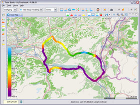
osm  map provider
OpenStreetMap
Version 10.3
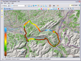
osm  with relief
OpenStreetMap with Relief
from


Version: 10.2 BETA (17. February 2010)

This will be the next version of MyTourbook and has currently these limitations:

  • Installation program is not yet available
  • New features are not yet translated

Some Test Remarks

There has been many modifications in the program code to support the new feature for customized map providers. Therefor it is possible that this BETA version can have errors which didn't surface during the development.

You can test this beta version with a different data directory where you store you tours, how to do this is described here

This version can be installed ONLY from the download site 10.2 BETA
New Reqirements
New Features
  • customize map providers
    most of the map providers which existed in previous versions are now removed but can be imported very easily as a custom map provider from this list or it can be created by your own.
  • Garmin FIT file import, provided by Alfred Barten
Improvements
  • import calories from tcx files, provided by Stefan Fussenegger
  • new fields for a tour (weather / rest pulse), provided by Kenny Moens
  • improved performance for painting the SRTM map
    (performance can be even more improved)
  • improved performance for painting map offline images
Modifications
  • separated language files
Bugfix
  • tours and markers in the map are not clipped any more at the tile border
Platform Update
  • Eclipse 3.5.2 RC2
Development
  • restructured plugins and subversion repository
Version 9.08
osm  map provider
OpenStreetMap
Version 10.2
osm  with relief
OpenStreetMap with Relief
from


2009

2011