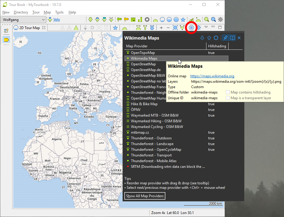
 2D Map Provider
Map provider slideout can be opened when ![]() is hovered with the mouse, installable 2D map providers are here.
is hovered with the mouse, installable 2D map providers are here.
Select a Map Provider
A map provider can be selected in the slideout but there are other possibilities to select a map provider
2D Map Toolbar
|
|
Mouse click |
Select next map provider |
|
|
Mouse click + <Ctrl> |
Select previous map provider |
2D Map Provider Slideout
|
|
|
Next map provider |
|
|
|
Previous map provider |
|
Mouse wheel + <Ctrl>* |
Next/previous map provider |
* When map provider list is hovered
Map Provider Types
|
|
Custom |
|
|
Custom with hillshading |
|
|
Profile (with multiple layers) |
|
|
Profile with hillshading |
|
|
Transparent |
|
|
Transparent with hillshading |
|
|
Internal (cannot be modified) |
Internal Map Providers
|
OpenStreetMap |
Is the default map provider from OpenStreetMap |
|
SRTM |
This map is not loaded from the internet, it is painted within this application and is based on the following data:
This map is drawing the same elevation with the same color but the color for each elevation can be customized. The customization is done in the preference dialog which is described here. ... please be patient ... When this map displays a location which was never displayed before, the elevation data will be downloaded automatically. This will delay the painting of the map but the data files are downloaded only once and are saved locally for reuse. The download status is displayed in the status line when the tile info is not hidden, this can be defined here. |
This page is updated for version 19.7


