

Merge Tours
The tour merge tool can merge data from one tour into another tour. This is very handy when you have a device which can not record all data you want and you have a second device which can record the desired data.
The only requirement to merge tours is, both tours must contain time slices, therefore manually created tours are excluded because they do not have these data.
Terms |
 |
Terms
The merged tours are distinguished by their name in this description and in the application they use these names:
Source Tour
Is the tour which data is merged into the target tour.
Target Tour
Is the tour which receives data from a source tour.
Conditions
- The target tour must be saved before the source tour can be assigned.
- The source tour is automatically saved when the tours are merged, however to hide the source tour in other views or statistics, a tour type for the source tour can be set when the tours are merged.
- Currently, altitude values can only be merged, when both tours contain altitude values.
- Supported data which can be merged: altitude, heartbeat, temperature and cadence.
- The merge tool is only available in the Tour Import
 view.
view.
Assign Merge Tour
When you have read the terms and accepted the conditions, merging the tours can begin:
- Source and target tour must be imported in the Tour Import view.
- Select source tour.
- Select
 Merge »...« into... in the view context menu.
 - The sub menu will display all tours which are displayed in the import view, these tours have been saved and contain recorded time slice values.
- When a target tour is selected in the sub menu, the merge tour dialog is opened.
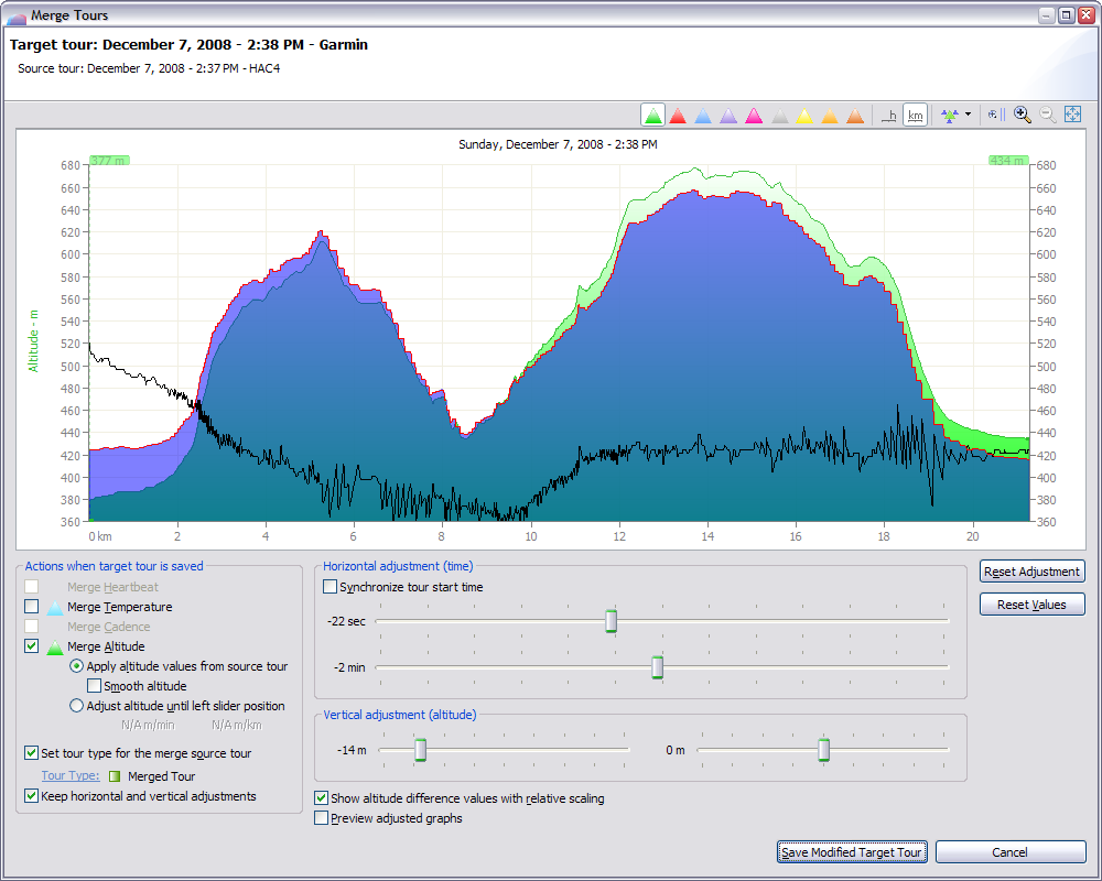
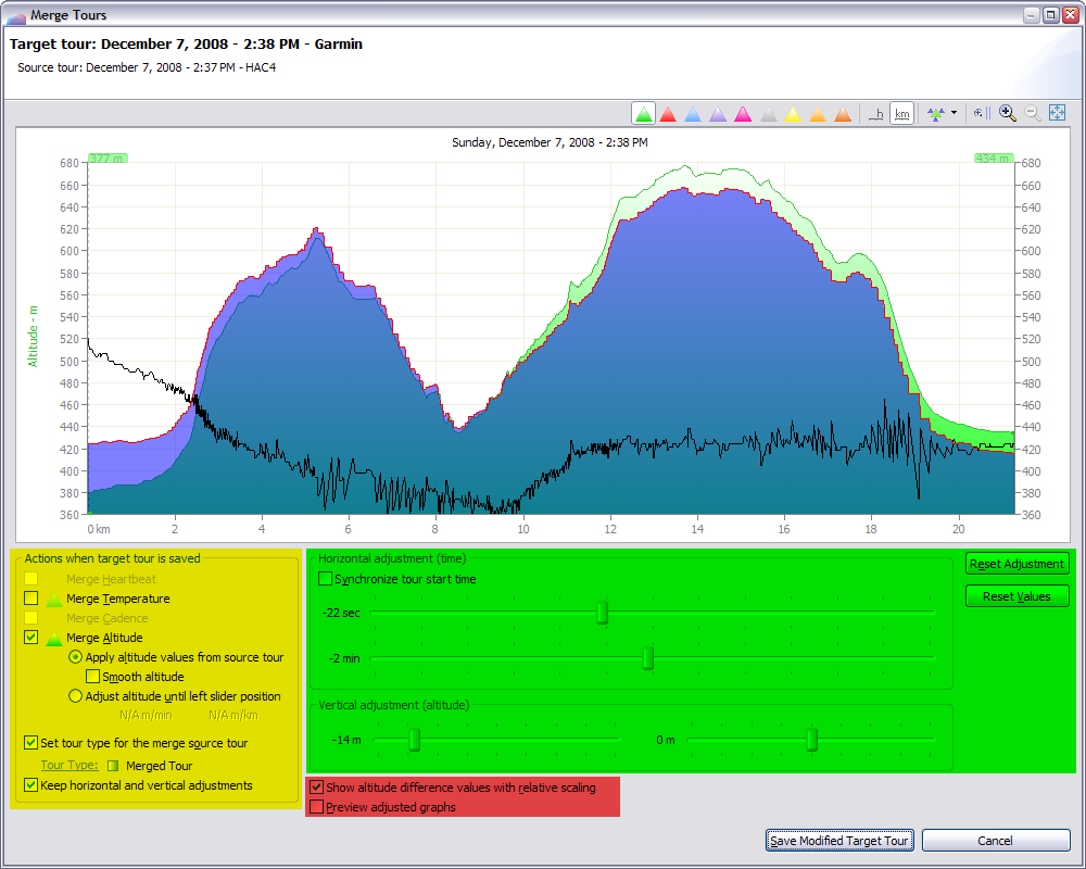
Merge Tour Dialog
|
This dialog has different areas:
|
 |
| Tour Chart |
The tour chart displays the target tour and the graphs which are checked in the Save Actions area.
There are some additional graphs in the tour chart when altitude values are available:
|
Red line |
Altitude graph of the source tour. |
|
Black line |
Altitude difference between source and target tour. |
|
Blue filled area |
When Merge Altitude is checked, the blue filled area displays the altitude graph of the merged target tour. |
| Save Actions |
All checked actions will be done when the button Save Modified Target Tour is pressed.
|
Merge Heartbeat/Temperature/Cadence |
These actions are enabled when the source tour contains the corresponding data. |
|
Merge Altitude |
This action is enabled, when the source and the target tour contains altitude values. |
|
Apply altitude values from source tour |
This will merge the altitude values from the source into the target tour. |
|
Smooth altitude |
This will smooth the merged altitude graph. |
|
Adjust altitude until left slider position |
This will adjust the altitude graph in the target tour from the tour start until the left slider position, the adjustment is done with a linear algorithm. This option can be very helpfull to adjust the altitude when the altitude at the start position is total wrong in the GPS device and the device will adjust the altitude automatically over a longer time period. When you have adjusted the horizontal and vertical position, move the left slider to the right until the altitude difference graph displays a minimum. This can be a hour or longer after the tour start. |
|
Set tour type for the source tour |
Sets the tour type in the source tour with the selected tour type. |
|
Keep horizontal and vertical adjustments |
This option cannot be unchecked because this is the default behaviour when the save button is pressed and no other actions are checked. |
| Horizontal and Vertical Adjustments |
This allows the adjustment for the position of the source tour relative to the position of the target tour.
|
Synchronize tour start time |
Sets the horizontal positon for the source tour exactly to the same time as the target tour. When both tours have exactly the correct time, this option can be used for the horzontal position, otherwise the horizontal positon can be adjusted with the sliders. The time sliders will show the time differences between synchronized start time. |
|
Time sliders |
The time can be adjusted for the source tour in the range of +/- 2 hours. |
|
Altitude sliders |
The altitude can be adjusted for the source tour in the ranges of +/- 420 m. |
|
Reset Adjustment |
Resets time and altitude adjustments to 0. |
|
Reset Values |
Resets time and altitude adjustments to the saved values. |
| View Options |
|
Show altitude difference values with relative scaling |
This option can toggle the scaling for the altitude difference values between relative and absolute. When relative scaling is enabled, the maximum height for the graph is always half amount of the chart graph height. |
|
Preview adjusted graphs |
When this option is enabled, the tour chart will be updated immediatedly when the vert/horiz adjustment is modified. This is helpful to see the adjusted merged data but slows down the painting of the tour chart. This option is not necessary to display the merged altitude graph values because they are painted directly. |
Modify Merged Tour
When a target tour is selected in the Tour Import ![]() or in in the Tour Book
or in in the Tour Book ![]() view, the merge tour dialog can be opened with the action Modify Merged Tour...
view, the merge tour dialog can be opened with the action Modify Merged Tour... ![]() in the view context menu.
in the view context menu.
